Former church
Introduction
The photograph on this page of Former church by Michael Dibb as part of the Geograph project.
The Geograph project started in 2005 with the aim of publishing, organising and preserving representative images for every square kilometre of Great Britain, Ireland and the Isle of Man.

There are currently over 7.5m images from over 14,400 individuals and you can help contribute to the project by visiting https://www.geograph.org.uk
Former church
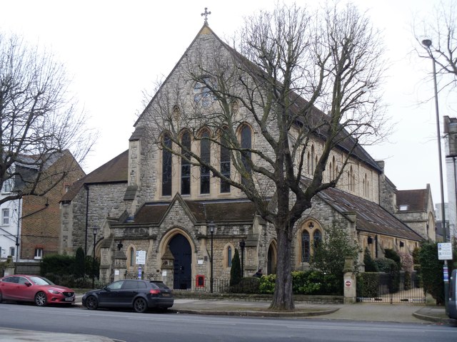
Image: © Michael Dibb Taken: 26 Jan 2017
This former Anglican church was built 1862-4, closed in 1986 and was converted into residential apartments.
Images are licensed for reuse under creativecommons.org/licenses/by-sa/2.0
Image Location
Latitude
51.467254
Longitude
-0.296292