Rugby ground
Introduction
The photograph on this page of Rugby ground by Michael Dibb as part of the Geograph project.
The Geograph project started in 2005 with the aim of publishing, organising and preserving representative images for every square kilometre of Great Britain, Ireland and the Isle of Man.

There are currently over 7.5m images from over 14,400 individuals and you can help contribute to the project by visiting https://www.geograph.org.uk
Rugby ground
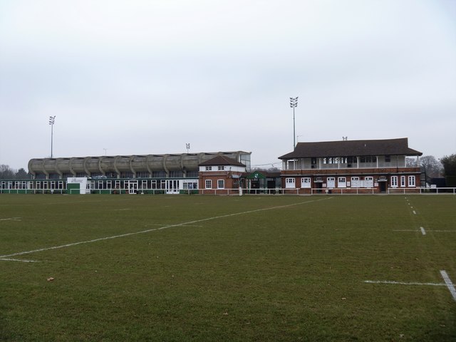
Image: © Michael Dibb Taken: 26 Jan 2017
The training ground of London Welsh Rugby Club. The main ground is the other side of the grandstand. The pavilion at the right of the modern grandstand was built circa 1886 and is listed, grade II, with details at: https://historicengland.org.uk/listing/the-list/list-entry/1031522
Images are licensed for reuse under creativecommons.org/licenses/by-sa/2.0
Image Location
Latitude
51.465738
Longitude
-0.303402