Park Lane
Introduction
The photograph on this page of Park Lane by Ian Capper as part of the Geograph project.
The Geograph project started in 2005 with the aim of publishing, organising and preserving representative images for every square kilometre of Great Britain, Ireland and the Isle of Man.

There are currently over 7.5m images from over 14,400 individuals and you can help contribute to the project by visiting https://www.geograph.org.uk
Park Lane
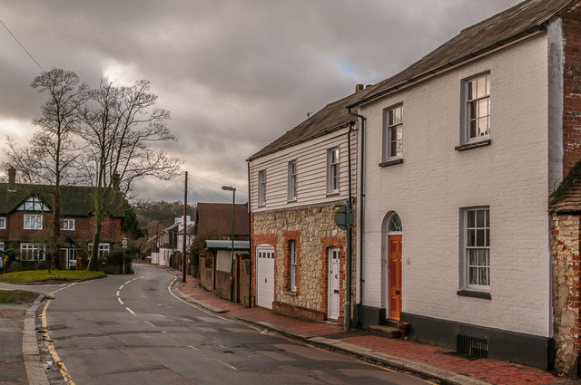
Image: © Ian Capper Taken: 8 Jan 2011
Looking south along Park Lane from near its junction with High Street. The cottage on the right of the photo, no 6, dates from the early/mid 19th Century and is grade II listed - see www.historicengland.org.uk/listing/the-list/list-entry/1029096. In the left background is Makepeace (see Image).
Images are licensed for reuse under creativecommons.org/licenses/by-sa/2.0
Image Location
Latitude
51.237661
Longitude
-0.210482