Totteridge & Whetstone Station
Introduction
The photograph on this page of Totteridge & Whetstone Station by Stephen McKay as part of the Geograph project.
The Geograph project started in 2005 with the aim of publishing, organising and preserving representative images for every square kilometre of Great Britain, Ireland and the Isle of Man.

There are currently over 7.5m images from over 14,400 individuals and you can help contribute to the project by visiting https://www.geograph.org.uk
Totteridge & Whetstone Station
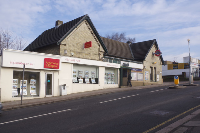
Image: © Stephen McKay Taken: 6 Feb 2017
With a name more reminiscent of a country railway closed in the Beeching era than the Northern Line, this station stands on Totteridge Lane, the road connecting Whetstone with Totteridge. It was opened by the Great Northern Railway in 1872 (originally as Whetstone & Totteridge) and became a constituent part of the London Underground network in 1940.
Images are licensed for reuse under creativecommons.org/licenses/by-sa/2.0
Image Location
Latitude
51.630146
Longitude
-0.179228