Castle Archdale
Introduction
The photograph on this page of Castle Archdale by Kenneth Allen as part of the Geograph project.
The Geograph project started in 2005 with the aim of publishing, organising and preserving representative images for every square kilometre of Great Britain, Ireland and the Isle of Man.

There are currently over 7.5m images from over 14,400 individuals and you can help contribute to the project by visiting https://www.geograph.org.uk
Castle Archdale
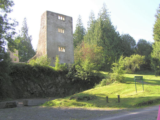
Image: © Kenneth Allen Taken: 7 Sep 2005
Castle Archdale Country Park is situated about 10 miles north west of Enniskillen. John Archdale from East Anglia came to live here on the shores of Lower Loch Erne in about 1614 after he acquired this estate of 1000 acres as part of the Plantation of Ulster. But the castle he built to defend his property was “put to the torch by Maguire” in the rebellion of 1641 and is now this towered ruin at the southern end of the present Country Park of 230 acres http://www.castlearchdale.com/ 2500 people lived here during the 1939-45 war when the Park was a flying boat base for harrying German submarines in the Western Approaches. They accounted for about ten U-boats and participated in the sinking of the battleship Bismark http://www.geograph.org.uk/photo/789466
Images are licensed for reuse under creativecommons.org/licenses/by-sa/2.0
Image Location


Leaflet Map data © OpenStreetMap
Latitude
54.487215
Longitude
-7.713754