Hezlett House
Introduction
The photograph on this page of Hezlett House by Kenneth Allen as part of the Geograph project.
The Geograph project started in 2005 with the aim of publishing, organising and preserving representative images for every square kilometre of Great Britain, Ireland and the Isle of Man.

There are currently over 7.5m images from over 14,400 individuals and you can help contribute to the project by visiting https://www.geograph.org.uk
Hezlett House
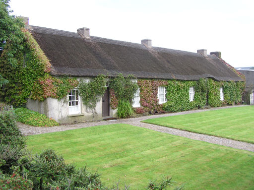
Image: © Kenneth Allen Taken: 26 Aug 2005
17th Century thatched cottage and farmyard and one of only a few buildings in Northern Ireland to survive from before the 18th century. Interesting cruck-truss roof construction
Images are licensed for reuse under creativecommons.org/licenses/by-sa/2.0
Image Location


Leaflet Map data © OpenStreetMap
Latitude
55.153397
Longitude
-6.783976