Converted Warehouse
Introduction
The photograph on this page of Converted Warehouse by Bob Harvey as part of the Geograph project.
The Geograph project started in 2005 with the aim of publishing, organising and preserving representative images for every square kilometre of Great Britain, Ireland and the Isle of Man.

There are currently over 7.5m images from over 14,400 individuals and you can help contribute to the project by visiting https://www.geograph.org.uk
Converted Warehouse
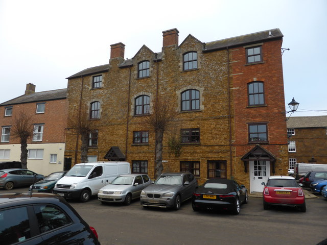
Image: © Bob Harvey Taken: 26 Jan 2017
This is the front elevation of Image, as seen from the Bullring. Like the rear, it superficially shows unfortunate lack of attention to detail in the conversion to accommodation. But on inspection I have no doubt that the brick addition is not new, and it is tied into the stone fascia with original bonding. The arched brick lintel is probably an early 20th century attempt to mimic the ones to the left of it. The other two windows on that section appear to be contemporary. So the hotch-potch is original, not down to the recent conversion, and may have informed or justified the rather clumsier attempts at the rear. Apart from these details, the whole building has a solid charm, and I would be interested to know for what commercial use it was originally intended.
Images are licensed for reuse under creativecommons.org/licenses/by-sa/2.0
Image Location


Leaflet Map data © OpenStreetMap
Latitude
51.982075
Longitude
-1.321441