Wadebridge bus station
Introduction
The photograph on this page of Wadebridge bus station by Derek Harper as part of the Geograph project.
The Geograph project started in 2005 with the aim of publishing, organising and preserving representative images for every square kilometre of Great Britain, Ireland and the Isle of Man.

There are currently over 7.5m images from over 14,400 individuals and you can help contribute to the project by visiting https://www.geograph.org.uk
Wadebridge bus station
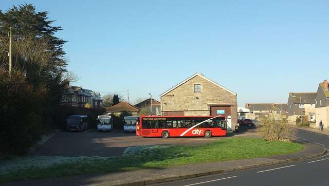
Image: © Derek Harper Taken: 23 Jan 2017
On Southern Way (right), which carries the Camel Trail. The bus station stands across part of the site of the former Wadebridge station, "one of the oldest railway stations in the country" http://www.disused-stations.org.uk/w/wadebridge/ and the former goods shed, the gabled building behind the red bus, is now the Betty Fisher Centre, a Rethink Mental Illness centre.
Images are licensed for reuse under creativecommons.org/licenses/by-sa/2.0
Image Location
Latitude
50.514524
Longitude
-4.83368