Junction at Blisland
Introduction
The photograph on this page of Junction at Blisland by Derek Harper as part of the Geograph project.
The Geograph project started in 2005 with the aim of publishing, organising and preserving representative images for every square kilometre of Great Britain, Ireland and the Isle of Man.

There are currently over 7.5m images from over 14,400 individuals and you can help contribute to the project by visiting https://www.geograph.org.uk
Junction at Blisland
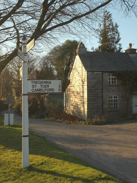
Image: © Derek Harper Taken: 25 Jan 2017
The C18 Beechtree Cottage, in the background, is listed and described at https://www.historicengland.org.uk/listing/the-list/list-entry/1142364 . This is at the west end of the village green.
Images are licensed for reuse under creativecommons.org/licenses/by-sa/2.0
Image Location
Latitude
50.527983
Longitude
-4.683356