North Smercotess Warren, caravan parks and lakes, to Church End and Grimoldby: aerial 2017
Introduction
The photograph on this page of North Smercotess Warren, caravan parks and lakes, to Church End and Grimoldby: aerial 2017 by Chris as part of the Geograph project.
The Geograph project started in 2005 with the aim of publishing, organising and preserving representative images for every square kilometre of Great Britain, Ireland and the Isle of Man.

There are currently over 7.5m images from over 14,400 individuals and you can help contribute to the project by visiting https://www.geograph.org.uk
North Smercotess Warren, caravan parks and lakes, to Church End and Grimoldby: aerial 2017
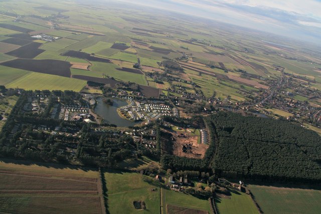
Image: © Chris Taken: 29 Jan 2017
The orange coloured square in the wood was until recently also covered in trees. Church End centre. Keeling Street and South Road lead off to the right and converge on Conisholme, with Conisholme Windfarm above. Covenham Reservoir top right.
Images are licensed for reuse under creativecommons.org/licenses/by-sa/2.0
Image Location
Latitude
53.442888
Longitude
0.152433