Ferry Lane level crossing, Rainham
Introduction
The photograph on this page of Ferry Lane level crossing, Rainham by Robin Webster as part of the Geograph project.
The Geograph project started in 2005 with the aim of publishing, organising and preserving representative images for every square kilometre of Great Britain, Ireland and the Isle of Man.

There are currently over 7.5m images from over 14,400 individuals and you can help contribute to the project by visiting https://www.geograph.org.uk
Ferry Lane level crossing, Rainham
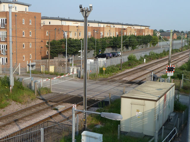
Image: © Robin Webster Taken: 24 Apr 2011
No longer a public vehicle crossing over the LTSR, as Ferry Lane is severed by the Channel Tunnel Rail Link (CTRL) just off to the right. It continues as a foot crossing, as there is a footbridge (the viewpoint) over the CTRL, and also provides level access to Rainham station up platform. It also gives road vehicle access to railway infrastructure via an access road running east between the two lines - CTRL and LTSR.
Images are licensed for reuse under creativecommons.org/licenses/by-sa/2.0
Image Location
Latitude
51.516445
Longitude
0.190981