No 8, New Street/Chapel Square
Introduction
The photograph on this page of No 8, New Street/Chapel Square by Richard Law as part of the Geograph project.
The Geograph project started in 2005 with the aim of publishing, organising and preserving representative images for every square kilometre of Great Britain, Ireland and the Isle of Man.

There are currently over 7.5m images from over 14,400 individuals and you can help contribute to the project by visiting https://www.geograph.org.uk
No 8, New Street/Chapel Square
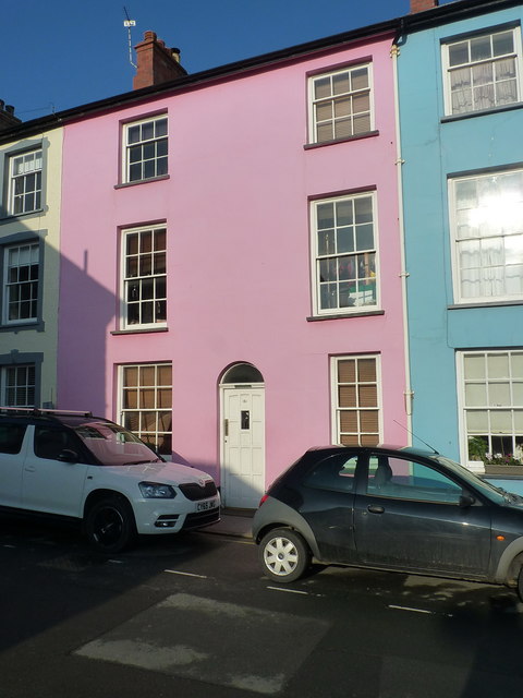
Image: © Richard Law Taken: 23 Jan 2017
An un-named house on Chapel Square, but one of three given a Grade II listed building status in 1994 for their state of preservation and character as mid 19th century Georgian townhouses. The listing details for this one are at http://www.britishlistedbuildings.co.uk/wa-14300-no-8-new-street-n-side-aberdyfi-aberdovey#.WI7xOlOLSM8
Images are licensed for reuse under creativecommons.org/licenses/by-sa/2.0
Image Location


Leaflet Map data © OpenStreetMap
Latitude
52.544531
Longitude
-4.044558