Summer house, Moel Gyffylog
Introduction
The photograph on this page of Summer house, Moel Gyffylog by Jonathan Wilkins as part of the Geograph project.
The Geograph project started in 2005 with the aim of publishing, organising and preserving representative images for every square kilometre of Great Britain, Ireland and the Isle of Man.

There are currently over 7.5m images from over 14,400 individuals and you can help contribute to the project by visiting https://www.geograph.org.uk
Summer house, Moel Gyffylog
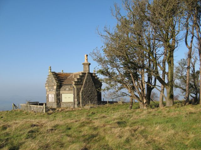
Image: © Jonathan Wilkins Taken: 26 Jan 2017
The summit of Moel Gyffylog is occupied by a curious and sturdily-built summer house or folly with a wind-blown plantation. Boarded-up windows command the view in almost all directions from the hill-top. This is private land with no right of way, so I am grateful for permission to visit.
Images are licensed for reuse under creativecommons.org/licenses/by-sa/2.0
Image Location
Latitude
53.223862
Longitude
-3.764743