Bo-Peep Junction and Bo-Peep Tunnel, Western Portal
Introduction
The photograph on this page of Bo-Peep Junction and Bo-Peep Tunnel, Western Portal by Simon Carey as part of the Geograph project.
The Geograph project started in 2005 with the aim of publishing, organising and preserving representative images for every square kilometre of Great Britain, Ireland and the Isle of Man.

There are currently over 7.5m images from over 14,400 individuals and you can help contribute to the project by visiting https://www.geograph.org.uk
Bo-Peep Junction and Bo-Peep Tunnel, Western Portal
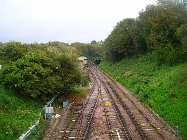
Image: © Simon Carey Taken: 14 Aug 2007
Cut into the side of a hill marked as Bo-Peep on the 1804 map. The name derives from the action of 'looking out for' which was first recorded in the 14th century and which is found along many stretches of coastline often overlooking well known smuggling haunts. The cliffs to the right offered an uninterrupted view of the then undeveloped coastline between Hastings and Bexhill and particularly the nearby beaches of Bulverhythe which was a popular landing spot. The name was consequently given to a nearby inn which in turn gave the name to both the railway junction and tunnel.
Images are licensed for reuse under creativecommons.org/licenses/by-sa/2.0
Image Location
Latitude
50.852824
Longitude
0.541367