
Woolston signal box
Introduction
The photograph on this page of Woolston signal box by Rob Candlish as part of the Geograph project.
The Geograph project started in 2005 with the aim of publishing, organising and preserving representative images for every square kilometre of Great Britain, Ireland and the Isle of Man.

There are currently over 7.5m images from over 14,400 individuals and you can help contribute to the project by visiting https://www.geograph.org.uk
Woolston signal box
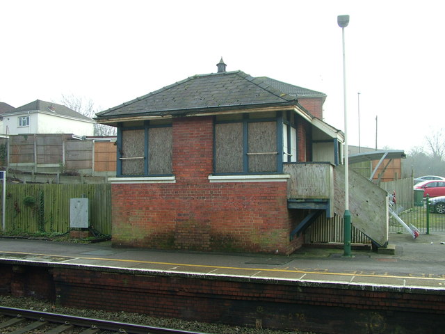
Image: © Rob Candlish Taken: 23 Jan 2017
An interesting comparison with http://www.geograph.org.uk/photo/598919 showing the box in happier days in October 2007. Since then the windows have been boarded up and the name sign has vanished. The building is listed Grade II and “Any object or structure fixed to the principal building or buildings and any object or structure within the curtilage of the building, which, although not fixed to the building, forms part of the land and has done so since before 1st July, 1948 is by law to be treated as part of the listed building” [Source: Historic England]. The removal of the name sign therefore seems to be in contravention of the listing.
Images are licensed for reuse under creativecommons.org/licenses/by-sa/2.0
Image Location

Latitude
50.898976
Longitude
-1.377114