
The Caiy Stane
Introduction
The photograph on this page of The Caiy Stane by M J Richardson as part of the Geograph project.
The Geograph project started in 2005 with the aim of publishing, organising and preserving representative images for every square kilometre of Great Britain, Ireland and the Isle of Man.

There are currently over 7.5m images from over 14,400 individuals and you can help contribute to the project by visiting https://www.geograph.org.uk
The Caiy Stane
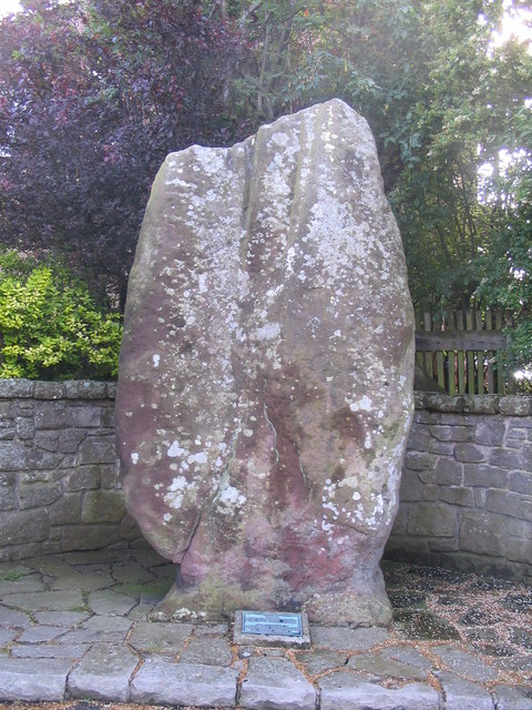
Image: © M J Richardson Taken: 15 Aug 2007
About 3m high, the Caiy Stane is a broad slab of red sandstone possibly marking a ritual or burial place from Neolithic times. The hilltop where it is sited continued to be used in the Bronze Age, and it may also have been the site of a battle in more recent times, with the stone as a memorial. The reverse face has six, probably prehistoric cup marks, some old graffiti and some more recent spray-painted defacings.
Images are licensed for reuse under creativecommons.org/licenses/by-sa/2.0
Image Location

Latitude
55.90255
Longitude
-3.212934