Cairn on Ridge hill, East Moor
Introduction
The photograph on this page of Cairn on Ridge hill, East Moor by Jim Champion as part of the Geograph project.
The Geograph project started in 2005 with the aim of publishing, organising and preserving representative images for every square kilometre of Great Britain, Ireland and the Isle of Man.

There are currently over 7.5m images from over 14,400 individuals and you can help contribute to the project by visiting https://www.geograph.org.uk
Cairn on Ridge hill, East Moor
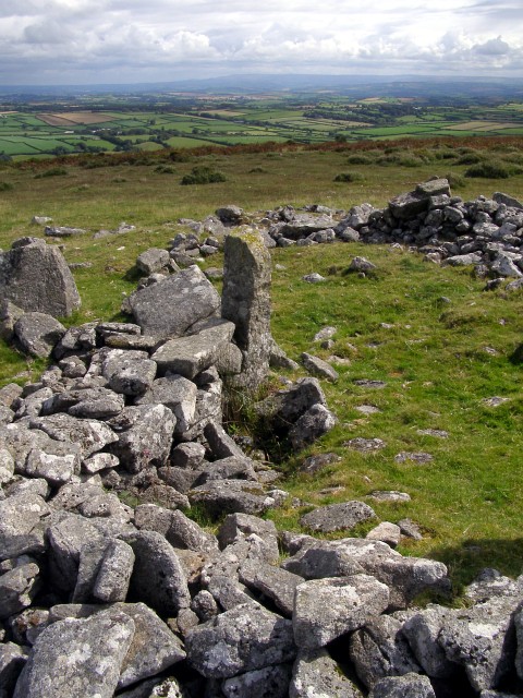
Image: © Jim Champion Taken: 13 Aug 2007
This cairn is at the eastern end of the summit of (the appropriately named) Ridge hill, marked as a 'tumulus' on the OS map. It looks as if it could have been adapted to use as a sheep pen in more recent times. The monument's scheduling says that it is 22.7 metres in diameter and up to 1.3 metres high. Partial excavation in the nineteenth century revealed a central slab over a cremation burial, surrounded by concentric rings of slabs in the cairn's mound. In the distance are the green fields of the farmland to the northeast of the moor.
Images are licensed for reuse under creativecommons.org/licenses/by-sa/2.0
Image Location


Leaflet Map data © OpenStreetMap
Latitude
50.573453
Longitude
-4.482689