Park, Tetcott
Introduction
The photograph on this page of Park, Tetcott by Derek Harper as part of the Geograph project.
The Geograph project started in 2005 with the aim of publishing, organising and preserving representative images for every square kilometre of Great Britain, Ireland and the Isle of Man.

There are currently over 7.5m images from over 14,400 individuals and you can help contribute to the project by visiting https://www.geograph.org.uk
Park, Tetcott
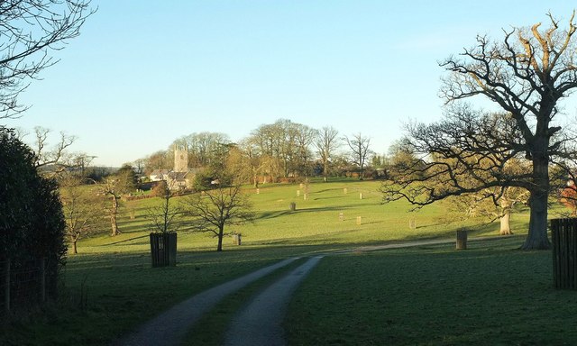
Image: © Derek Harper Taken: 19 Jan 2017
Tetcott Footpath 11 sets out along a carriage drive across the parkland of Tetcott Manor towards the grade I listed Holy Cross church Image, which is at risk https://historicengland.org.uk/advice/heritage-at-risk/search-register/list-entry/1669535 . The area with tree guards is mapped as "The Wilderness".
Images are licensed for reuse under creativecommons.org/licenses/by-sa/2.0
Image Location
Latitude
50.744398
Longitude
-4.363435