1839 datestone, Newhall Lane
Introduction
The photograph on this page of 1839 datestone, Newhall Lane by Stephen Craven as part of the Geograph project.
The Geograph project started in 2005 with the aim of publishing, organising and preserving representative images for every square kilometre of Great Britain, Ireland and the Isle of Man.

There are currently over 7.5m images from over 14,400 individuals and you can help contribute to the project by visiting https://www.geograph.org.uk
1839 datestone, Newhall Lane
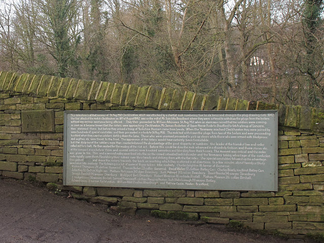
Image: © Stephen Craven Taken: 14 Jan 2017
The stone at the left of the photo is accompanied by an information plaque that says it is all that was left from St Peg Mill in Cleckheaton, destroyed by chartist rioters in 1842, and giving a detailed account of the riot.
Images are licensed for reuse under creativecommons.org/licenses/by-sa/2.0
Image Location
Latitude
53.666163
Longitude
-1.683654