Cleared site of Medical Centre
Introduction
The photograph on this page of Cleared site of Medical Centre by Lairich Rig as part of the Geograph project.
The Geograph project started in 2005 with the aim of publishing, organising and preserving representative images for every square kilometre of Great Britain, Ireland and the Isle of Man.

There are currently over 7.5m images from over 14,400 individuals and you can help contribute to the project by visiting https://www.geograph.org.uk
Cleared site of Medical Centre
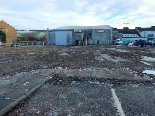
Image: © Lairich Rig Taken: 13 Jan 2017
The Medical Centre in Bank Street, Alexandria, is shown being demolished in Image / Image / Image The view direction of the last of those pictures corresponds to that of the present picture, which is a view through the boundary fence of the site; the remains of the building itself have been cleared away. Ahead, at the centre and on the right, are the backs of buildings on Mitchell Way.
Images are licensed for reuse under creativecommons.org/licenses/by-sa/2.0
Image Location
Latitude
55.986996
Longitude
-4.580498