Chinley Station track panorama
Introduction
The photograph on this page of Chinley Station track panorama by Bobby Clegg as part of the Geograph project.
The Geograph project started in 2005 with the aim of publishing, organising and preserving representative images for every square kilometre of Great Britain, Ireland and the Isle of Man.

There are currently over 7.5m images from over 14,400 individuals and you can help contribute to the project by visiting https://www.geograph.org.uk
Chinley Station track panorama
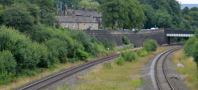
Image: © Bobby Clegg Taken: 13 Aug 2015
A view of the track layout looking east from the footbridge. The site has the appearance of having accommodated much more track than there is at present. The plate girder bridge with its block stone parapet carries Stubbins Lane (I think!) across the railway whilst the large retaining wall to the left of the bridge also lofts Stubbins Lane above railway level.
Images are licensed for reuse under creativecommons.org/licenses/by-sa/2.0
Image Location
Latitude
53.341095
Longitude
-1.940035