Alice Ottley School
Introduction
The photograph on this page of Alice Ottley School by Philip Halling as part of the Geograph project.
The Geograph project started in 2005 with the aim of publishing, organising and preserving representative images for every square kilometre of Great Britain, Ireland and the Isle of Man.

There are currently over 7.5m images from over 14,400 individuals and you can help contribute to the project by visiting https://www.geograph.org.uk
Alice Ottley School
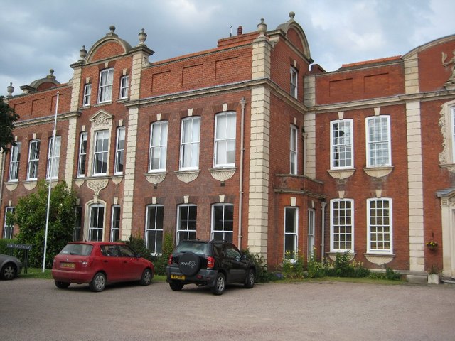
Image: © Philip Halling Taken: 1 Jul 2008
Alice Ottley School is part of the Worcester Royal Grammar School and occupies Britannia House which is Grade II* listed https://www.historicengland.org.uk/listing/the-list/list-entry/1390240. The building dates from 1730-50 with later editions, it became a school in 1883; it stands on the east side of Upper Tything.
Images are licensed for reuse under creativecommons.org/licenses/by-sa/2.0
Image Location
Latitude
52.199229
Longitude
-2.224104