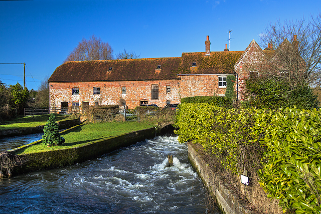
WWII Hampshire - Ringwood Stop Line, Avon Valley - Breamore Mill (1)
Introduction
The photograph on this page of WWII Hampshire - Ringwood Stop Line, Avon Valley - Breamore Mill (1) by Mike Searle as part of the Geograph project.
The Geograph project started in 2005 with the aim of publishing, organising and preserving representative images for every square kilometre of Great Britain, Ireland and the Isle of Man.
There are currently over 7.5m images from over 14,400 individuals and you can help contribute to the project by visiting https://www.geograph.org.uk

Image: © Mike Searle Taken: 13 Jan 2017
General view north of Breamore Mill from the bridge over the western channel of the Avon. In 1940, the natural barrier that was the River Avon between Christchurch and Salisbury became part of a line of defence along the Avon Valley and the A338 trunk road known as the 'Ringwood Stop Line'. It was designed in anticipation of an enemy invasion that saw the fortification as 'anti-tank islands' of Christchurch, Fordingbridge and Salisbury. In addition, major crossing points of the Avon were also defended to varying degrees. One of these crossing points was at Breamore Mill, where evidence still remains of some of the defences that were in place at that time. During WWII the village of Breamore became a defended locality, almost certainly centred on Breamore Mill whose main building straddles the western of two main channels of the River Avon. The river is crossed here by a minor road from Breamore village to Woodgreen via two bridges overlooked by the Mill and its outbuildings. The Mill would have been requisitioned under wartime emergency regulations, and occupied by members of the Home Guard. The defences consisted of three pillboxes supplemented by observation posts, slit trenches, land mines or demolition charges, fougasses, and barbed wire, and possibly a spigot mortar emplacement, but no trace of that has ever been found. There was also a roadblock sited probably between the two road bridges over the river that may have been formed by vertical steel rails in the road surface. All that remains today are three pillboxes, one quite outstanding specimen is in an outbuilding that probably commanded the position adjacent to the roadblock, whilst another was built against the northwest corner of the Mill itself. A third was built north of the Mill alongside the river bank against what was once apparently a pump house, but is now a store. Image
Image Location


