Development site, 3 Main Street, Ballyclare (January 2017)
Introduction
The photograph on this page of Development site, 3 Main Street, Ballyclare (January 2017) by Albert Bridge as part of the Geograph project.
The Geograph project started in 2005 with the aim of publishing, organising and preserving representative images for every square kilometre of Great Britain, Ireland and the Isle of Man.

There are currently over 7.5m images from over 14,400 individuals and you can help contribute to the project by visiting https://www.geograph.org.uk
Development site, 3 Main Street, Ballyclare (January 2017)
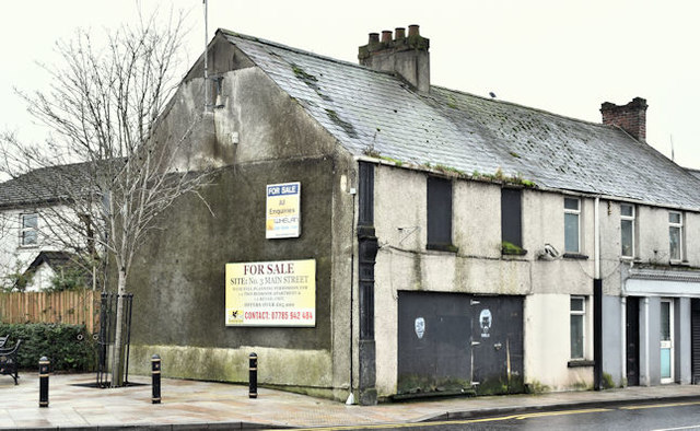
Image: © Albert Bridge Taken: 8 Jan 2017
A derelict property at the roundabout (south eastern) end of Main Street. The gable sign advises “With full planning permission 1 x bedroom apartment & 1 x retail unit”. This photograph appears as a matter of record only. I have no connection with any of the parties involved in the sale.
Images are licensed for reuse under creativecommons.org/licenses/by-sa/2.0
Image Location
Latitude
54.750109
Longitude
-5.99684