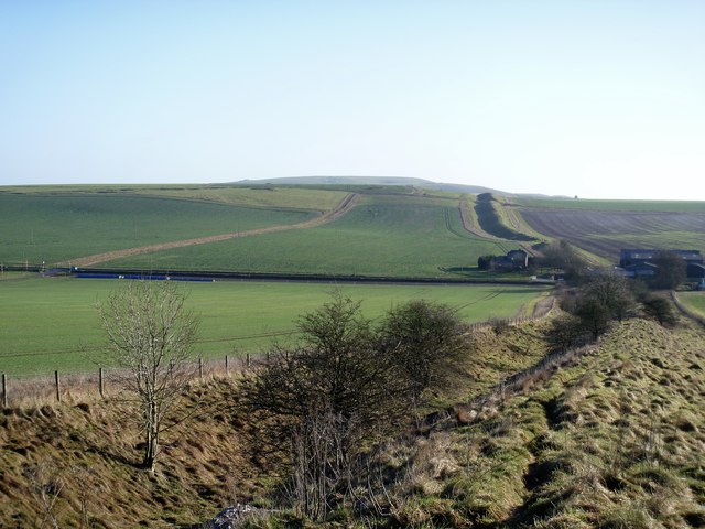
Wansdyke [4]
Introduction
The photograph on this page of Wansdyke [4] by Michael Dibb as part of the Geograph project.
The Geograph project started in 2005 with the aim of publishing, organising and preserving representative images for every square kilometre of Great Britain, Ireland and the Isle of Man.
There are currently over 7.5m images from over 14,400 individuals and you can help contribute to the project by visiting https://www.geograph.org.uk

Image: © Michael Dibb Taken: 2 Jan 2017
Seen from the dyke itself, the impressive Wansdyke runs down to cross the A361 road then strides over Roughridge Hill on Bishop's Cannings Down beyond. This is one of the best preserved sections of the earthwork. In two parts, Wansdyke is a series of early medieval defensive linear earthworks, consisting of a ditch and a running embankment from the ditch spoil, with the ditching facing north. There are two main parts: an eastern dyke which runs between Savernake Forest and Morgan's Hill in Wiltshire, and a western dyke which runs from Monkton Combe to the ancient hill fort of Maes Knoll in historic Somerset. Between these two dykes there is a middle section formed by the remains of the London to Bath Roman road. Wansdyke is a scheduled ancient monument and there is much details at: https://www.historicengland.org.uk/listing/the-list/list-entry/1017288

