Duke's Place, Hockley, Nottingham 1
Introduction
The photograph on this page of Duke's Place, Hockley, Nottingham 1 by David Hallam-Jones as part of the Geograph project.
The Geograph project started in 2005 with the aim of publishing, organising and preserving representative images for every square kilometre of Great Britain, Ireland and the Isle of Man.

There are currently over 7.5m images from over 14,400 individuals and you can help contribute to the project by visiting https://www.geograph.org.uk
Duke's Place, Hockley, Nottingham 1
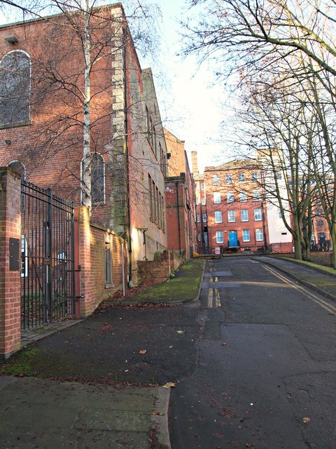
Image: © David Hallam-Jones Taken: 2 Jan 2017
Inside these gates lie what remains of a former burial ground that is now known as The Bellar Rest Garden. This seems likely to have been part of the nearby Barker Gate Burial Ground in Barker Gate. After ceasing to be used for this purpose this plot became a rest garden (date unknown). More recently, perhaps for the past 10 years or so, it has asphalted and used as a car park, without very much attention to the fact that it was the last resting place of the bones of a good number of local people. A few ancient gravestones can still be viewed around the edges of the car park. The history of the burial ground is traceable back to 1742 when a plot of land on Barker Gate was acquired from the Duke of Kingston for the sum of ten shillings. In the 1830s these burial grounds were used to accommodate the remains of the victims of a cholera epidemic in Nottingham in which 330 people. In 1883 authorisation was granted to take down two of the burial ground walls to allow for an extension of St Mary’s School, i.e the building ahead, immediately beyond the gates. The building in which the school was housed was originally a Baptist chapel (hence the shape of the windows perhaps?). The chapel was redesigned and converted into this school in 1886 by the well known local architect Thomas Chambers Hine. This part of the building appears to be empty at present, although other parts of the old school to the rear appear to be in use as offices. Directly ahead some waist-high security gates prevent vehicles from using this road, apart from allowing access to some former factory buildings, meanwhile the A60 lies a stone's throw away behind the photographer.
Images are licensed for reuse under creativecommons.org/licenses/by-sa/2.0
Image Location
Latitude
52.952206
Longitude
-1.141443