5 to 9 Bute Crescent
Introduction
The photograph on this page of 5 to 9 Bute Crescent by Michael Dibb as part of the Geograph project.
The Geograph project started in 2005 with the aim of publishing, organising and preserving representative images for every square kilometre of Great Britain, Ireland and the Isle of Man.

There are currently over 7.5m images from over 14,400 individuals and you can help contribute to the project by visiting https://www.geograph.org.uk
5 to 9 Bute Crescent
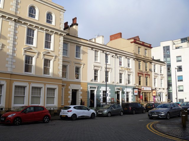
Image: © Michael Dibb Taken: 11 Dec 2016
Now occupied by a motley collection of hotels and eating houses, this row of former houses was built circa 1840. They are all listed, grade II, as is the Ocean building to the left which incorporates number 9. For details see: http://cadwpublic-api.azurewebsites.net/reports/listedbuilding/FullReport?lang=en&id=13952 http://cadwpublic-api.azurewebsites.net/reports/listedbuilding/FullReport?lang=en&id=13953 http://cadwpublic-api.azurewebsites.net/reports/listedbuilding/FullReport?lang=en&id=13954 http://cadwpublic-api.azurewebsites.net/reports/listedbuilding/FullReport?lang=en&id=13955 http://cadwpublic-api.azurewebsites.net/reports/listedbuilding/FullReport?lang=en&id=13956
Images are licensed for reuse under creativecommons.org/licenses/by-sa/2.0
Image Location
Latitude
51.464036
Longitude
-3.165087