
WW2 pillbox near Wroughton Airfield
Introduction
The photograph on this page of WW2 pillbox near Wroughton Airfield by Vieve Forward as part of the Geograph project.
The Geograph project started in 2005 with the aim of publishing, organising and preserving representative images for every square kilometre of Great Britain, Ireland and the Isle of Man.

There are currently over 7.5m images from over 14,400 individuals and you can help contribute to the project by visiting https://www.geograph.org.uk
WW2 pillbox near Wroughton Airfield
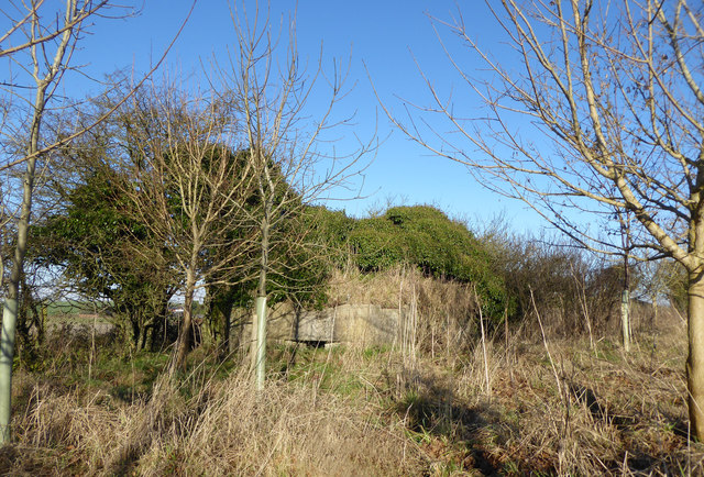
Image: © Vieve Forward Taken: 28 Dec 2016
Type FW3/22 pillbox, part of RAF Wroughton's WW2 ground defences. The Defence of Britain Archive describes it thus: 'A regular hexagon pillbox with 6 embrasures. It is well constructed of concrete with brick shuttering and external cement cladding. All the embrasures and the door are still unblocked. Inside, 4 embrasures have the remains of Turnbull mounts. The pillbox is at the NW corner of the airfield and has a SW main arc. It is sited at the highest point (210m) in the area and has a commanding view. It appears to be sited on its own, although it could originally have had a partner, the site of which is now occupied by a water tank.' https://archaeologydataservice.ac.uk/archives/view/dob/ai_full_r.cfm?refno=210 See also Image] for another view of the same pillbox.
Images are licensed for reuse under creativecommons.org/licenses/by-sa/2.0
Image Location

Latitude
51.507261
Longitude
-1.812353