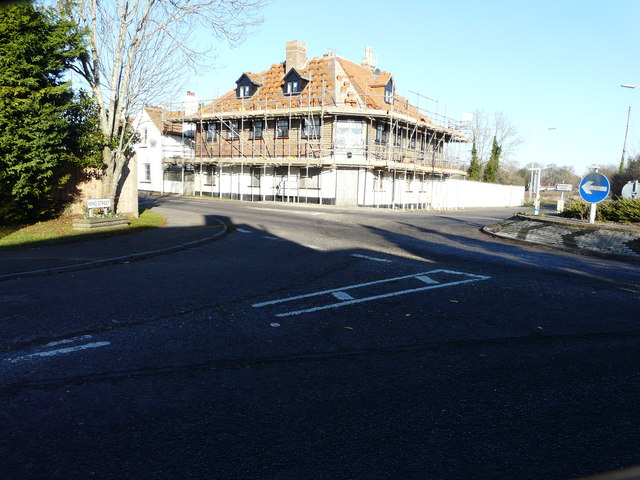
Re-roofing the former Fleur de Lis Inn
Introduction
The photograph on this page of Re-roofing the former Fleur de Lis Inn by John Baker as part of the Geograph project.
The Geograph project started in 2005 with the aim of publishing, organising and preserving representative images for every square kilometre of Great Britain, Ireland and the Isle of Man.
There are currently over 7.5m images from over 14,400 individuals and you can help contribute to the project by visiting https://www.geograph.org.uk

Image: © John Baker Taken: 4 Dec 2016
Work is ongoing to the former Image Planning permission has been approved, with conditions, by Folkestone and Hythe District Council under application numbers Y15/341/SH for the “change of use and conversion of the former public house to provide ground floor retail and office use (Class A1/B1), and 4 self contained flats in the upper floors, together with erection of a three storey side extension with the upper floor in the roof space and other external alterations and associated parking and landscaping” and Y15/0342/SH for “listed building consent for the erection of a three storey side extension with the upper floor in the roof space and other external and internal alterations in connection with change of use and conversion of the former public house”. It is a grade II listed building dating from the mid 19th century http://www.britishlistedbuildings.co.uk/en-175466-the-fleur-de-lys-public-house-the-fleur-#.WGQLhv5vjcd (note: the incorrect spelling of lis in the link)
Image Location


