Church Road, Upper Soudley
Introduction
The photograph on this page of Church Road, Upper Soudley by Stephen McKay as part of the Geograph project.
The Geograph project started in 2005 with the aim of publishing, organising and preserving representative images for every square kilometre of Great Britain, Ireland and the Isle of Man.

There are currently over 7.5m images from over 14,400 individuals and you can help contribute to the project by visiting https://www.geograph.org.uk
Church Road, Upper Soudley
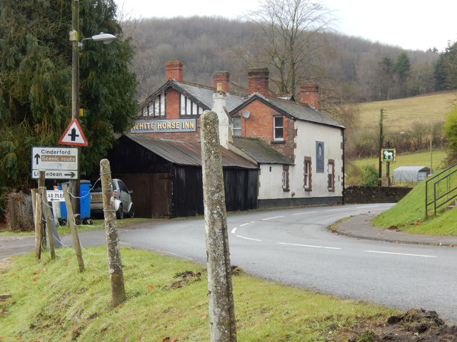
Image: © Stephen McKay Taken: 11 Dec 2016
Ahead is the White Horse Inn. The road through the heart of the Forest of Dean is designated a scenic route. The entrance on the immediate left gives access to the pub car park but at one time there was a station here on the long-closed Cinderford branch.
Images are licensed for reuse under creativecommons.org/licenses/by-sa/2.0
Image Location


Leaflet Map data © OpenStreetMap
Latitude
51.79192
Longitude
-2.497269