Palmer Road Vicinity, Hucknall, Notts.
Introduction
The photograph on this page of Palmer Road Vicinity, Hucknall, Notts. by David Hallam-Jones as part of the Geograph project.
The Geograph project started in 2005 with the aim of publishing, organising and preserving representative images for every square kilometre of Great Britain, Ireland and the Isle of Man.

There are currently over 7.5m images from over 14,400 individuals and you can help contribute to the project by visiting https://www.geograph.org.uk
Palmer Road Vicinity, Hucknall, Notts.
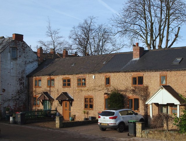
Image: © David Hallam-Jones Taken: 17 Dec 2016
A row of former (C19th?) malthouse cottages a stone's throw from the newly created mini-roundabout at the town centre end of Annesley Road. A new 'town centre relief road' (opened in November 2016), that provides motorists with a way of avoiding the soon-to-be-opened pedestrianised section of High Street, passes in front of these houses, separated by a new 6ft tall sandstone wall. Prior to the commencement of the town centre improvement scheme - started in January 2016 and due to be completed in May 2017 - these houses were much less visible to passers-by by virtue of being situated in a secluded mill lane (a cul-de-sac). The property occupiers now have a 14-16 ft tarmacked area between their boundary walls and the relief road's boundary wall. Behind them lies Palmer Avenue and another residential street called The Connery.
Images are licensed for reuse under creativecommons.org/licenses/by-sa/2.0
Image Location
Latitude
53.03975
Longitude
-1.204136