Baker Street, Hucknall, Notts.
Introduction
The photograph on this page of Baker Street, Hucknall, Notts. by David Hallam-Jones as part of the Geograph project.
The Geograph project started in 2005 with the aim of publishing, organising and preserving representative images for every square kilometre of Great Britain, Ireland and the Isle of Man.

There are currently over 7.5m images from over 14,400 individuals and you can help contribute to the project by visiting https://www.geograph.org.uk
Baker Street, Hucknall, Notts.
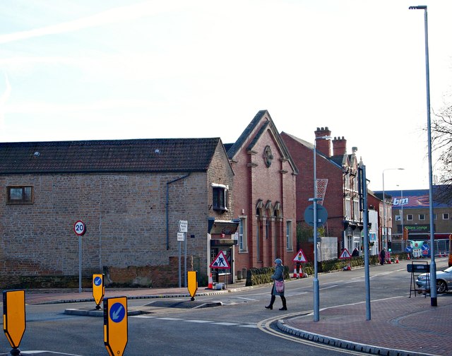
Image: © David Hallam-Jones Taken: 17 Dec 2016
One of the features of the town centre improvement scheme (TCIS) is to be the creation of a pedestrianised section of High Street between Baker Street and Watnall Road. The scheme received final funding approval from the Department for Transport in February 2015 (procured using the Medium Scheme Framework 2, through the Midlands Highway Alliance). Carillion/Tarmac JV were awarded the contract and the work started on site in January 2016 with an anticipated completion date of May 2017. The project aims to reduce traffic congestion, create an attractive shopping centre, attract new retailers and to assist in the regeneration of the town. The side elevation of the building straight ahead is that of a former malthouse. In addition, the prominent Central Methodist Church - seen from a new mini-roundabout at the town centre end of Annesley Road - faces the town's market square, although the latter is not visible here. A car is waiting to come out of Ogle Street. One end of the proposed pedestrianised section of the High Street will begin (or end) behind the security barriers ahead on the left. Motorists can opt to join one end of the newly opened (November 2016) 'town centre relief road' on the photographer's left.
Images are licensed for reuse under creativecommons.org/licenses/by-sa/2.0
Image Location
Latitude
53.039664
Longitude
-1.204734