South side of the railway bridge near Crosskeys railway station
Introduction
The photograph on this page of South side of the railway bridge near Crosskeys railway station by Jaggery as part of the Geograph project.
The Geograph project started in 2005 with the aim of publishing, organising and preserving representative images for every square kilometre of Great Britain, Ireland and the Isle of Man.

There are currently over 7.5m images from over 14,400 individuals and you can help contribute to the project by visiting https://www.geograph.org.uk
South side of the railway bridge near Crosskeys railway station
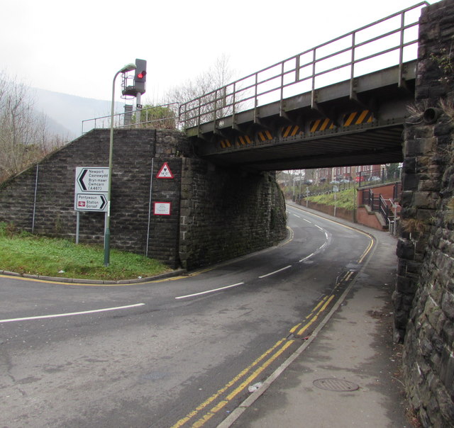
Image: © Jaggery Taken: 17 Dec 2016
Immediately NW of Crosskeys railway station, the bridge carries two railway tracks over the southern end of the B4591 High Street. The warning sign on the left shows that the headroom under the bridge is 14' 0". A direction sign points right towards the road under the bridge for the entrance to Crosskeys railway station, and the road to Pontywaun.
Images are licensed for reuse under creativecommons.org/licenses/by-sa/2.0
Image Location
Latitude
51.621049
Longitude
-3.126636