Wantz Lake
Introduction
The photograph on this page of Wantz Lake by Marathon as part of the Geograph project.
The Geograph project started in 2005 with the aim of publishing, organising and preserving representative images for every square kilometre of Great Britain, Ireland and the Isle of Man.

There are currently over 7.5m images from over 14,400 individuals and you can help contribute to the project by visiting https://www.geograph.org.uk
Wantz Lake
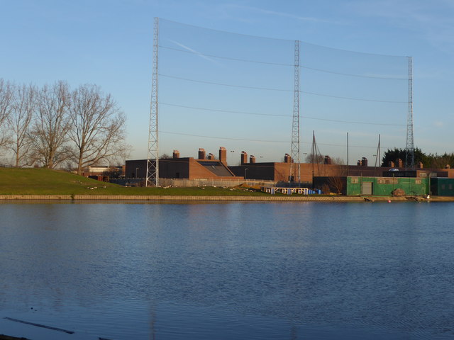
Image: © Marathon Taken: 14 Dec 2016
Wantz Lake is a circular artificial lake on the upper reaches of the Wantz Stream. It serves as a balancing reservoir to control flooding further downstream. It also features in a golf driving range although I would imagine the majority of balls must end up in the lake. The high net is to stop the golf balls ending up hitting the houses beyond although one would imagine many balls hitting the netting would also end up in the lake! See also http://www.geograph.org.uk/photo/5227021
Images are licensed for reuse under creativecommons.org/licenses/by-sa/2.0
Image Location
Latitude
51.563747
Longitude
0.157038