House building at Worsbrough
Introduction
The photograph on this page of House building at Worsbrough by Paul Harrop as part of the Geograph project.
The Geograph project started in 2005 with the aim of publishing, organising and preserving representative images for every square kilometre of Great Britain, Ireland and the Isle of Man.

There are currently over 7.5m images from over 14,400 individuals and you can help contribute to the project by visiting https://www.geograph.org.uk
House building at Worsbrough
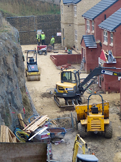
Image: © Paul Harrop Taken: 13 Dec 2016
Construction site on the north side of Bank End Road, seen from the footpath alongside St Thomas's Church. The site has been created by levelling part of the steep hillside, as seen from the high retaining walls in the background and on the left.
Images are licensed for reuse under creativecommons.org/licenses/by-sa/2.0
Image Location
Latitude
53.534674
Longitude
-1.460282