Entrance to the Federation Jewish Cemetery, Rainham
Introduction
The photograph on this page of Entrance to the Federation Jewish Cemetery, Rainham by Marathon as part of the Geograph project.
The Geograph project started in 2005 with the aim of publishing, organising and preserving representative images for every square kilometre of Great Britain, Ireland and the Isle of Man.

There are currently over 7.5m images from over 14,400 individuals and you can help contribute to the project by visiting https://www.geograph.org.uk
Entrance to the Federation Jewish Cemetery, Rainham
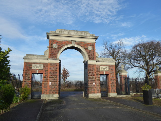
Image: © Marathon Taken: 14 Dec 2016
The imposing entrance to the Federation Jewish Cemetery, Rainham can be seen for quite some distance across the flat fields here on the edge of the Green Belt. Upminster Road North is just beyond. A total of 106 acres for the cemetery was purchased in 1936. It was consecrated in February 1938. Rainham has a capacity for 45-50,000 graves and is at 60% of capacity.
Images are licensed for reuse under creativecommons.org/licenses/by-sa/2.0
Image Location
Latitude
51.52298
Longitude
0.221279