Path to the shore
Introduction
The photograph on this page of Path to the shore by Lairich Rig as part of the Geograph project.
The Geograph project started in 2005 with the aim of publishing, organising and preserving representative images for every square kilometre of Great Britain, Ireland and the Isle of Man.

There are currently over 7.5m images from over 14,400 individuals and you can help contribute to the project by visiting https://www.geograph.org.uk
Path to the shore
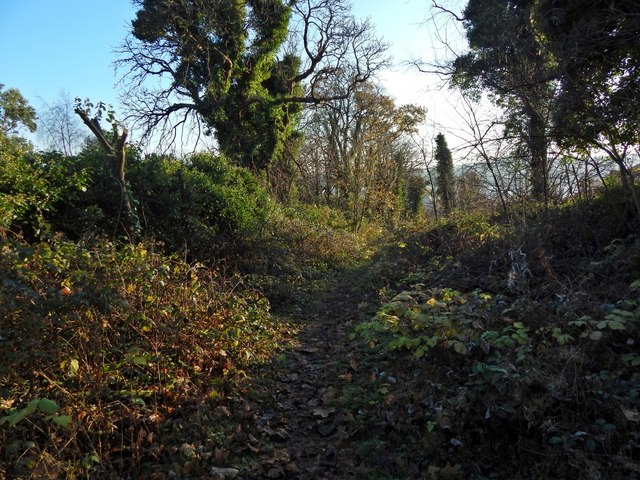
Image: © Lairich Rig Taken: 4 Dec 2016
The path is the one shown in Image, but the view is from further ahead. The path is becoming overgrown, but it is (at the time of writing) one of the local council's core paths (path 20, length 237 metres). The far end of the path is shown in Image, from another path, one that runs parallel to the shore.
Images are licensed for reuse under creativecommons.org/licenses/by-sa/2.0
Image Location
Latitude
55.938989
Longitude
-4.580986