The Old Burgh Hall
Introduction
The photograph on this page of The Old Burgh Hall by Lairich Rig as part of the Geograph project.
The Geograph project started in 2005 with the aim of publishing, organising and preserving representative images for every square kilometre of Great Britain, Ireland and the Isle of Man.

There are currently over 7.5m images from over 14,400 individuals and you can help contribute to the project by visiting https://www.geograph.org.uk
The Old Burgh Hall
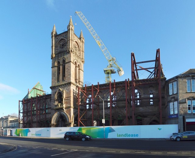
Image: © Lairich Rig Taken: 4 Dec 2016
This is the former Image After the fire described at that link, the building shown in Image was built behind the surviving facade. At the time the present picture was taken, that building had, in turn, been demolished, and the site was being redeveloped; the new West Dunbartonshire Council Offices are to be located there. Click on the end-note title for related pictures. The tall crane shown here was a prominent feature of the landscape for several months.
Images are licensed for reuse under creativecommons.org/licenses/by-sa/2.0
Image Location
Latitude
55.943768
Longitude
-4.56737