St Philips Mews, Aldrington, Hove
Introduction
The photograph on this page of St Philips Mews, Aldrington, Hove by Simon Carey as part of the Geograph project.
The Geograph project started in 2005 with the aim of publishing, organising and preserving representative images for every square kilometre of Great Britain, Ireland and the Isle of Man.

There are currently over 7.5m images from over 14,400 individuals and you can help contribute to the project by visiting https://www.geograph.org.uk
St Philips Mews, Aldrington, Hove
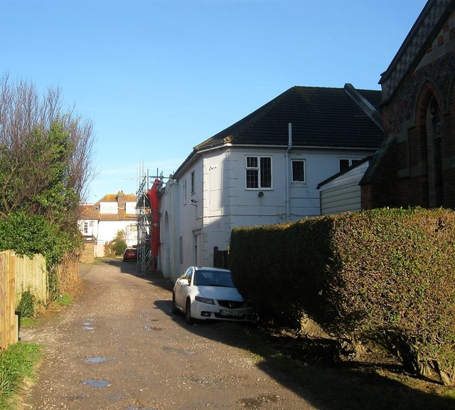
Image: © Simon Carey Taken: 11 Dec 2016
An unmade track off New Church Road that leads to Image, the western entrance of Image and three houses beyond the latter which were constructed in 1996. These dwellings meant the track required a name and was thus christened St Philips Mews after the church, part of which is visible on the right. This explains the anomaly of Charles Lodge (out of shot to the left) which was built in the 1920s and is officially number 75 New Church Road. The track itself was for many years known locally as Naismith Lane.
Images are licensed for reuse under creativecommons.org/licenses/by-sa/2.0
Image Location
Latitude
50.831014
Longitude
-0.189057