Carlisle city boundary stone, London Road
Introduction
The photograph on this page of Carlisle city boundary stone, London Road by Rose and Trev Clough as part of the Geograph project.
The Geograph project started in 2005 with the aim of publishing, organising and preserving representative images for every square kilometre of Great Britain, Ireland and the Isle of Man.

There are currently over 7.5m images from over 14,400 individuals and you can help contribute to the project by visiting https://www.geograph.org.uk
Carlisle city boundary stone, London Road
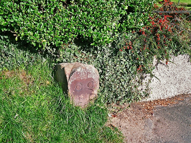
Image: © Rose and Trev Clough Taken: 3 Oct 2016
Red sandstone marker located between Nos 417 and 419 London Road. Inscribed : CC 1912. In that year the municipal borough and civil parish of Carlisle was extended, taking in the townships of Harraby, Upperby, and Botcherby together with parts of Belle Vue, Cummersdale and Stanwix (Kelly's directory of Cumberland and Westmorland, 1914).
Images are licensed for reuse under creativecommons.org/licenses/by-sa/2.0
Image Location
Latitude
54.873547
Longitude
-2.901317