Pistyll Goleu from above
Introduction
The photograph on this page of Pistyll Goleu from above by Alan Bowring as part of the Geograph project.
The Geograph project started in 2005 with the aim of publishing, organising and preserving representative images for every square kilometre of Great Britain, Ireland and the Isle of Man.

There are currently over 7.5m images from over 14,400 individuals and you can help contribute to the project by visiting https://www.geograph.org.uk
Pistyll Goleu from above
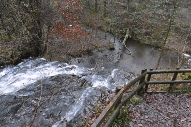
Image: © Alan Bowring Taken: 10 Dec 2016
The path descends immediately adjacent to the fall, giving the opportunity for perspectives from above, beside and below. The confluence of the Sychnant with the Nant Clydach is seen to be almost immediately beneath the drop. Both of these stream names are common in south Wales.
Images are licensed for reuse under creativecommons.org/licenses/by-sa/2.0
Image Location
Latitude
51.657504
Longitude
-3.398895