Chequers Inn, Leominster
Introduction
The photograph on this page of Chequers Inn, Leominster by Philip Halling as part of the Geograph project.
The Geograph project started in 2005 with the aim of publishing, organising and preserving representative images for every square kilometre of Great Britain, Ireland and the Isle of Man.

There are currently over 7.5m images from over 14,400 individuals and you can help contribute to the project by visiting https://www.geograph.org.uk
Chequers Inn, Leominster
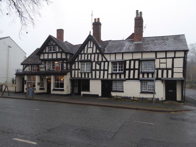
Image: © Philip Halling Taken: 6 Dec 2016
My first impression was that this building was all part of the Chequers Inn, however, having referred to the Historic England website I discover the inn is just the building to the left and dates from the 16th century See: https://www.historicengland.org.uk/listing/the-list/list-entry/1270300 The buildings to the right are listed as three cottages, 63, 65 and 67, Etnam Street, also dating back to the 16th century. All are Grade II listed buildings. See: https://www.historicengland.org.uk/listing/the-list/list-entry/1255442
Images are licensed for reuse under creativecommons.org/licenses/by-sa/2.0
Image Location
Latitude
52.226279
Longitude
-2.735329