Site of "Lorne Arms" - December 2016
Introduction
The photograph on this page of Site of "Lorne Arms" - December 2016 by The Carlisle Kid as part of the Geograph project.
The Geograph project started in 2005 with the aim of publishing, organising and preserving representative images for every square kilometre of Great Britain, Ireland and the Isle of Man.

There are currently over 7.5m images from over 14,400 individuals and you can help contribute to the project by visiting https://www.geograph.org.uk
Site of "Lorne Arms" - December 2016
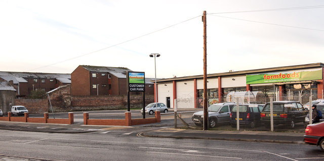
Image: © The Carlisle Kid Taken: 5 Dec 2016
Situated on the corner of Broadguards and Shaddongate (just to the right in this shot, where the cars are parked), the pub dated to circa 1837 when it was known as the "Weaver's Arms". Acquired by the State in August 1916 it was closed in 1919 and demolished in 1968. Photograph is for record only - I have no connection with any business seen in this view and cannot advise on their products or services.
Images are licensed for reuse under creativecommons.org/licenses/by-sa/2.0
Image Location
Latitude
54.892804
Longitude
-2.945247