Dumbarton Railway Bridge
Introduction
The photograph on this page of Dumbarton Railway Bridge by Lairich Rig as part of the Geograph project.
The Geograph project started in 2005 with the aim of publishing, organising and preserving representative images for every square kilometre of Great Britain, Ireland and the Isle of Man.

There are currently over 7.5m images from over 14,400 individuals and you can help contribute to the project by visiting https://www.geograph.org.uk
Dumbarton Railway Bridge
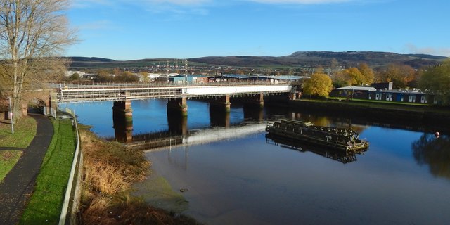
Image: © Lairich Rig Taken: 18 Nov 2016
The picture was taken on the same day as Image, but from a higher viewpoint, on the Image A cycle route can be seen on the left, and Image on the right. The railway bridge remained in normal use, but scaffolding had been erected along its length, on both the near and the far side. Just beyond the right-hand half of the bridge is a Image: see Image The rightmost third of the skyline is taken up by the Long Crags.
Images are licensed for reuse under creativecommons.org/licenses/by-sa/2.0
Image Location
Latitude
55.946756
Longitude
-4.574936