New flood defence works - Skipton
Introduction
The photograph on this page of New flood defence works - Skipton by Nigel Pepper as part of the Geograph project.
The Geograph project started in 2005 with the aim of publishing, organising and preserving representative images for every square kilometre of Great Britain, Ireland and the Isle of Man.

There are currently over 7.5m images from over 14,400 individuals and you can help contribute to the project by visiting https://www.geograph.org.uk
New flood defence works - Skipton
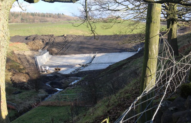
Image: © Nigel Pepper Taken: 4 Dec 2016
Flood defences for Skipton approaching completion. These flood defences were constructed in 2016 on Waller Hill Beck and are designed to reduce the risk of flooding in Skipton town centre where this beck and several others meet. This work forms a flood storage reservoir with a capacity of 162,000 cubic metres. The dam wall is 9.5m high and 105m long.
Images are licensed for reuse under creativecommons.org/licenses/by-sa/2.0
Image Location


Leaflet Map data © OpenStreetMap
Latitude
53.965878
Longitude
-1.98777