Portslade Station
Introduction
The photograph on this page of Portslade Station by Simon Carey as part of the Geograph project.
The Geograph project started in 2005 with the aim of publishing, organising and preserving representative images for every square kilometre of Great Britain, Ireland and the Isle of Man.

There are currently over 7.5m images from over 14,400 individuals and you can help contribute to the project by visiting https://www.geograph.org.uk
Portslade Station
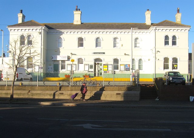
Image: © Simon Carey Taken: 3 Dec 2016
The current building dates from 1881 replacing the original station which was located on the western side of the level crossing. That had opened in 1840 but closed seven years later due to lack of use only reopening in 1857. By the 1870s both Portslade and Aldrington's population were increasing due to development. Despite the name the station is actually located in what was Aldrington parish which was later merged with Hove, its official full name being Portslade and West Hove.
Images are licensed for reuse under creativecommons.org/licenses/by-sa/2.0
Image Location
Latitude
50.835582
Longitude
-0.205354