Former mills, Brown street, Dundee
Introduction
The photograph on this page of Former mills, Brown street, Dundee by Chris Allen as part of the Geograph project.
The Geograph project started in 2005 with the aim of publishing, organising and preserving representative images for every square kilometre of Great Britain, Ireland and the Isle of Man.

There are currently over 7.5m images from over 14,400 individuals and you can help contribute to the project by visiting https://www.geograph.org.uk
Former mills, Brown street, Dundee
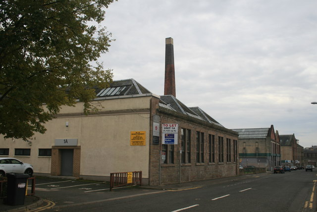
Image: © Chris Allen Taken: 21 Oct 2016
The closest single storey building is part of Dudhope Works and dates back to 1837. The car park in front is the site of a multi-storey turreted block of 1892 that has been demolished. Beyond it the chimney is part of Tay Works which was built for jute spinning and carpet weaving.
Images are licensed for reuse under creativecommons.org/licenses/by-sa/2.0
Image Location
Latitude
56.462852
Longitude
-2.98065