Valence Avenue, Becontree Estate
Introduction
The photograph on this page of Valence Avenue, Becontree Estate by Marathon as part of the Geograph project.
The Geograph project started in 2005 with the aim of publishing, organising and preserving representative images for every square kilometre of Great Britain, Ireland and the Isle of Man.

There are currently over 7.5m images from over 14,400 individuals and you can help contribute to the project by visiting https://www.geograph.org.uk
Valence Avenue, Becontree Estate
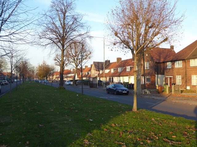
Image: © Marathon Taken: 30 Nov 2016
The London County Council decided to build the Becontree Estate to house many of the people from the East End of London displaced by slum clearance schemes. Barking and Dagenham, being almost flat and well-drained, offered an ideal site. Between 1920 and 1922 the LCC acquired 3,000 acres of land in Barking and Dagenham, as well as adjoining parts of Ilford, using compulsory purchase powers. Building started almost straight away, at first centred near Goodmayes and Chadwell Heath, and from 1923 around Dagenham Village. These centres soon joined up, and building continued until 1934. By 1932 the population had grown to 103,328 from 2,086 in 1922. Before development took place, most traces of the former landscape were obliterated. All the former farmhouses were demolished with the sole exception of Valence House which was saved when it was purchased from the LCC in 1926 by Dagenham Urban District Council. The landscape was largely devoid of trees and so it is difficult to find any tree within the Becontree Estate which pre-dates the development, other than those in the grounds of Valence House and Parsloes Park. There was a new layout of geometrically designed roads, sometimes with central reservations as here in Valence Avenue. Some of the pre-existing roads such as Wood Lane and Bennett's Castle Lane were retained, but others such as Gale Street and Broad Street were rerouted or lost.
Images are licensed for reuse under creativecommons.org/licenses/by-sa/2.0
Image Location
Latitude
51.556595
Longitude
0.130155