Stanmore Underground Station
Introduction
The photograph on this page of Stanmore Underground Station by Stephen McKay as part of the Geograph project.
The Geograph project started in 2005 with the aim of publishing, organising and preserving representative images for every square kilometre of Great Britain, Ireland and the Isle of Man.

There are currently over 7.5m images from over 14,400 individuals and you can help contribute to the project by visiting https://www.geograph.org.uk
Stanmore Underground Station
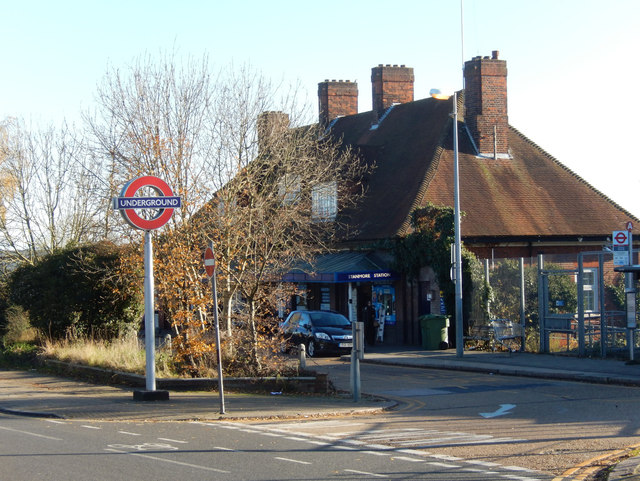
Image: © Stephen McKay Taken: 25 Nov 2016
Stanmore is at the northern end of the Jubilee Line, although when the station was first opened in 1932 it was on the Metropolitan Line, later becoming a branch of the Bakerloo. Of course, the Underground name is hardly appropriate here; it is a surface railway until Finchley Road.
Images are licensed for reuse under creativecommons.org/licenses/by-sa/2.0
Image Location
Latitude
51.619685
Longitude
-0.303301