Stryd-y-Tollty/Custom House Street
Introduction
The photograph on this page of Stryd-y-Tollty/Custom House Street by John Lucas as part of the Geograph project.
The Geograph project started in 2005 with the aim of publishing, organising and preserving representative images for every square kilometre of Great Britain, Ireland and the Isle of Man.

There are currently over 7.5m images from over 14,400 individuals and you can help contribute to the project by visiting https://www.geograph.org.uk
Stryd-y-Tollty/Custom House Street
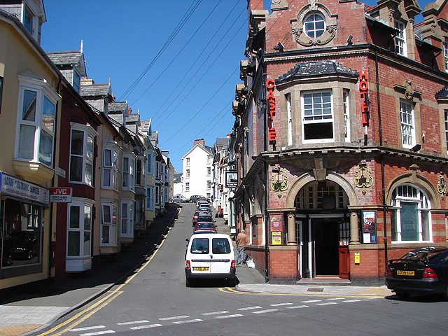
Image: © John Lucas Taken: 9 Aug 2007
Viewed here from South Road, Custom House Street was originally named Sea View Place. The reason for its current name is unclear as The Custom House was on the seafront, opposite the pier entrance. The pub on the corner is 'The Castle Hotel'.
Images are licensed for reuse under creativecommons.org/licenses/by-sa/2.0
Image Location


Leaflet Map data © OpenStreetMap
Latitude
52.412492
Longitude
-4.08829